File:Keuterville Neighbors1.png
Sarna News
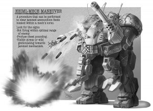
- Bad ‘Mechs - Sentinel
- HEXTECH Review - Wave 3 Brings More Urban Options To Your Battlefield
- Your BattleTech News Round-Up For March, 2024
- Crashing 'Mechs With Jennifer Brozek, Author Of The Rogue Academy Trilogy
- Getting The Word Out With Rem Alternis, Catalyst Community & Marketing Director
- Read more →


Revision as of 14:24, 25 February 2012 by Neuling (talk | contribs) ({{Image summary | summary = Map showing the location of the Keuterville system and neighbouring systems in 2571. | artist = Øystein Tvedten | source = ''Handbook: Major Periphery States'', p.121 | licensing = {{fair use}} }})
No higher resolution available.
Keuterville_Neighbors1.png (424 × 405 pixels, file size: 30 KB, MIME type: image/png)
Keuterville Neighbors1.png
Information:
Summary
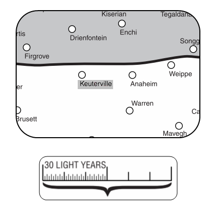
Map showing the location of the Keuterville system and neighbouring systems in 2571.
Artist
Øystein Tvedten
Source
Handbook: Major Periphery States, p.121
Licensing
 This work is copyrighted. The individual who uploaded this work and first used it in an article, and subsequent persons who place it into articles assert that this qualifies as fair use of the material under United States copyright law.
File history
Click on a date/time to view the file as it appeared at that time.
Date/Time Thumbnail Dimensions User Comment current 14:24, 25 February 2012 
424 × 405 (30 KB) Neuling (talk | contribs) {{Image summary | summary = Map showing the location of the Keuterville system and neighbouring systems in 2571. | artist = Øystein Tvedten | source = ''Handbook: Major Periphery States'', p.121 | licensing = {{fair use}} }}
You cannot overwrite this file.
File usage
The following page uses this file:
Metadata
Keuterville Neighbors1.png
| Information: | |
|---|---|
| Summary | Map showing the location of the Keuterville system and neighbouring systems in 2571. |
| Artist | Øystein Tvedten |
| Source | Handbook: Major Periphery States, p.121 |
| Licensing |
|

Click on a date/time to view the file as it appeared at that time.
| Date/Time | Thumbnail | Dimensions | User | Comment | |
|---|---|---|---|---|---|
| current | 14:24, 25 February 2012 | | 424 × 405 (30 KB) | Neuling (talk | contribs) | {{Image summary | summary = Map showing the location of the Keuterville system and neighbouring systems in 2571. | artist = Øystein Tvedten | source = ''Handbook: Major Periphery States'', p.121 | licensing = {{fair use}} }} |
You cannot overwrite this file.
The following page uses this file: