Difference between revisions of "Map Set 4"
Sarna News


m (Fixed double redirect) |
m (hyphen) |
||
| (5 intermediate revisions by 3 users not shown) | |||
| Line 1: | Line 1: | ||
| − | # | + | {{InfoBoxProduct |
| + | | image = MapSet4full.jpg | ||
| + | | name = Map Set #4 | ||
| + | | type = Map Set | ||
| + | | author = | ||
| + | | development = | ||
| + | | primarywriting = | ||
| + | | pages = 8 | ||
| + | | cover = | ||
| + | | interiorart = | ||
| + | | illustrations = | ||
| + | | publisher = [[FASA]] | ||
| + | | productioncode = FASA1663 | ||
| + | | year = 1991 | ||
| + | | ISBN10 = | ||
| + | | ISBN13 = | ||
| + | | MSRP = | ||
| + | | content = | ||
| + | | era = | ||
| + | | agency = | ||
| + | | universedate = | ||
| + | | timeline = | ||
| + | | scrollable timeline = [[Start date::]][[End date::]] | ||
| + | | series = Map Pack | ||
| + | | precededby = [[Map Set 3| Map Set #3]] | ||
| + | | followedby = [[Map Set 5| Map Set #5]] | ||
| + | }} | ||
| + | '' Map Set #4'' was a collection of [[Mapsheet|maps]] first published in 1991. A German-language edition was published in 1993 as "GeoTech III". | ||
| + | |||
| + | == Contents == | ||
| + | * Four 17” x 22", two-sided paper maps: | ||
| + | ** Heavy Forest #1 | ||
| + | ** Heavy Forest #2 | ||
| + | ** City Street Grid/Park #1 | ||
| + | ** City Street Grid/Park #2 | ||
| + | ** Large Lakes #1 | ||
| + | ** Large Lakes #2 | ||
| + | ** River Delta/Drainage Basin #1 | ||
| + | ** River Delta/Drainage Basin #2 | ||
| + | |||
| + | ==Gallery== | ||
| + | <gallery> | ||
| + | Image:MapHeavyForest1.jpg|Heavy Forest #1 | ||
| + | Image:MapHeavyForest2.jpg|Heavy Forest #2 | ||
| + | Image:MapCityStreetGridPark1.jpg|City Street Grid/Park #1 | ||
| + | Image:MapCityStreetGridPark2.jpg|City Street Grid/Park #2 | ||
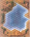
| + | Image:MapLargeLakes1.jpg|Large Lakes #1 | ||
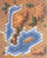
| + | Image:MapLargeLakes2.jpg|Large Lakes #2 | ||
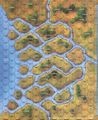
| + | Image:MapRiverDeltaDrainageBasin1.jpg|River Delta/Drainage Basin #1 | ||
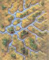
| + | Image:MapRiverDeltaDrainageBasin2.jpg|River Delta/Drainage Basin #2 | ||
| + | Image: MapSet4.jpg|Map Set 4 Cover | ||
| + | </gallery> | ||
| + | |||
| + | [[Category:Map Products]] | ||
Latest revision as of 15:21, 9 June 2022

| |
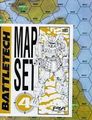
| Map Set #4 | |
|---|---|
| Product information | |
| Type | Map Set |
| Pages | 8 |
| Publication information | |
| Publisher | FASA |
| Product code | FASA1663 |
| First published | 1991 |
| Content | |
| Series | Map Pack |
| Preceded by | Map Set #3 |
| Followed by | Map Set #5 |
Map Set #4 was a collection of maps first published in 1991. A German-language edition was published in 1993 as "GeoTech III".
Contents[edit]
- Four 17” x 22", two-sided paper maps:
- Heavy Forest #1
- Heavy Forest #2
- City Street Grid/Park #1
- City Street Grid/Park #2
- Large Lakes #1
- Large Lakes #2
- River Delta/Drainage Basin #1
- River Delta/Drainage Basin #2
Gallery[edit]
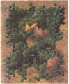
Heavy Forest #1
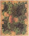
Heavy Forest #2
City Street Grid/Park #1
City Street Grid/Park #2
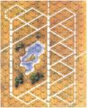
Large Lakes #1
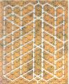
Large Lakes #2
River Delta/Drainage Basin #1
River Delta/Drainage Basin #2
Map Set 4 Cover


