Difference between revisions of "Elbing (HL)"
Sarna News


m (Text replacement - "Planets]]" to "Systems]]") |
m (punctuation, citation/whitespace) |
||
| Line 3: | Line 3: | ||
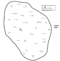
| caption = Elbing [[#Nearby_Systems|nearby systems]] (3151) | | caption = Elbing [[#Nearby_Systems|nearby systems]] (3151) | ||
| name = Elbing | | name = Elbing | ||
| − | | coord = | + | | coord = −831.863 : 819.224{{e}} |
| stars = | | stars = | ||
| class = | | class = | ||
| Line 18: | Line 18: | ||
--> | --> | ||
== Political Affiliation == | == Political Affiliation == | ||
| − | * [[3079]] - [[Hanseatic League]] <ref name="FR:Pp24">''Field Report: Periphery'', p. 24 | + | * [[3079]] - [[Hanseatic League]]<ref name="FR:Pp24">''Field Report: Periphery'', p. 24: "Last Known Deep Periphery Deployment Map"</ref> |
<!-- Commented out due to lack of information | <!-- Commented out due to lack of information | ||
-------------------------------------------------------------------------------- | -------------------------------------------------------------------------------- | ||
| Line 47: | Line 47: | ||
== Planetary History == | == Planetary History == | ||
| − | == Political Affiliation == | + | == Political Affiliation == |
== Planetary Rulers == | == Planetary Rulers == | ||
| Line 53: | Line 53: | ||
== Military Deployment == | == Military Deployment == | ||
| − | == Geography == | + | == Geography == |
== Planetary Locations == | == Planetary Locations == | ||
| Line 62: | Line 62: | ||
== Image gallery == | == Image gallery == | ||
<gallery> | <gallery> | ||
| − | Image:Hanseatic League 3079.jpg|Hanseatic League as | + | Image:Hanseatic League 3079.jpg|Hanseatic League as of 3079 |
</gallery> | </gallery> | ||
Revision as of 23:52, 14 November 2022
| Elbing | |
|---|---|
← 3135 3151 | |
_3151.svg) | |
| System Information | |
| X:Y Coordinates | −831.863 : 819.224[e] |
The Elbing system was the location of at least one habitable world or construct and (as of 3079) located in the Deep Periphery nation known as the Hanseatic League.[1] It was approximately 1,168 light-years from Terra in the coreward/anti-spinward direction.[e]
Contents
System Description
The Elbing system was located near the Anklan and Bremen systems.[1]
Political Affiliation
Image gallery
Hanseatic League as of 3079

Map Gallery
Nearby Systems
| Closest 20 systems (4 within 60 light-years) Distance in light years, closest systems first: | |||||||
|---|---|---|---|---|---|---|---|
| Bremen | 41.0 | Kalmar | 44.2 | Anklan | 49.1 | Riga | 51.7 |
| Falsterbo | 64.9 | Köningsberg | 78.4 | Bruges | 80.8 | Visby | 81.5 |
| Bergen | 100.4 | Dortmund | 105.2 | Dorpat | 119.2 | Wismar | 126.8 |
| Kampen | 127.4 | Lübeck | 128.6 | Stettin | 134.7 | Novgorod | 141.2 |
| Braunschweig | 147.6 | Lynn | 151.9 | Köln | 159.3 | Thorn | 163.1 |